
Development and use of large area analysis technology using drone images
This technology manages construction waste by linking video data using drones and 3D scanners with Building Information Modeling (BIM) information. By integrating this into a GIS based system, we developed a multi-purpose resource circulation system that provides information such as the lowest cost and the shortest-distance waste recycling circulation path and supports decision making.
Drones-based Construction Waste Calculation
It is a technology that can accurately calculate the volume of the building with DSM obtained through the flight of drones. It supports accurate calculation of construction waste compared to existing calculation methods.
3D Scan-Based Household Waste Volume Calculation
It supports the calculation of household waste through data post-processing that links the point cloud and BIM information acquired using a 3D scanner.

Current National R&D Performance Status
Year | Agency | Main tasks |
2017-2018 | Ministry of SMEs and Startups | Development of multi-purpose partitions and unstructured design tools for building cultural spaces |
2017-2018 | Ministry of SMEs and Startups | Development of multi-gimbal and aerial surveying software for sUAV |
2018-2019 | Ministry of Trade, Industry and Energy | Development of 3D Autonomous Flight Control Drone for Forest Management Using Smart DSM |
2018-2020 | MOLIT(Ministry of Land, Infrastructure and Transport) | A BIM-based multi-purpose construction waste management system linked to sUAV and 3D scanning |
2020-2021 | MOLIT | A fire risk assessment platform based on spatial information considering fire fighting facilities |
2020-2024 | Ministry of Science and ICT | DNA+ Drone Technology Development Project |
2021-2023 | MOLIT | Disaster prevention technology for inundation monitoring and response to inundation areas |
2022-2024 | MOLIT | Development of building energy digital diagnosis and design automation technology to promote green remodeling |
Development and utilization of energy digital diagnosis technology using drone
Diagnose and improve the energy performance of old buildings through digital building energy diagnosis. It measures the temperature changes that appear in the insulation of the building, windows and doors, and walls to determine the insulation of the building, water leakage, and inspect the safety and durability of the building. By acquiring the surface temperature, wind speed, emissivity, and reflection temperature required for thermal performance analysis of buildings, you can create 3D realistic models or 3D thermal imaging models through photogrammetry-based post-processing programs. (Performing)
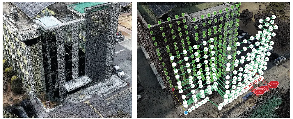
LiDAR point cloud
Create a drone photography mission
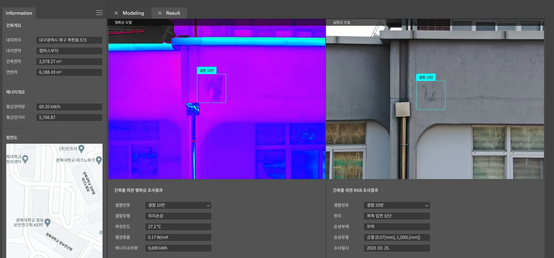
Thermal imaging digital diagnostic system
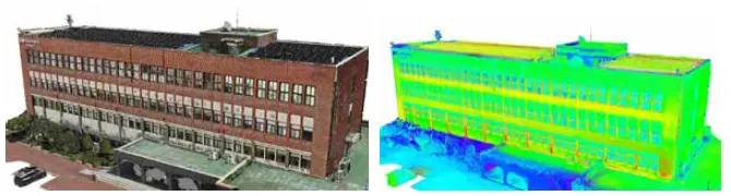
Realistic 3D Model of Architecture
Thermal Imaging 3D Model
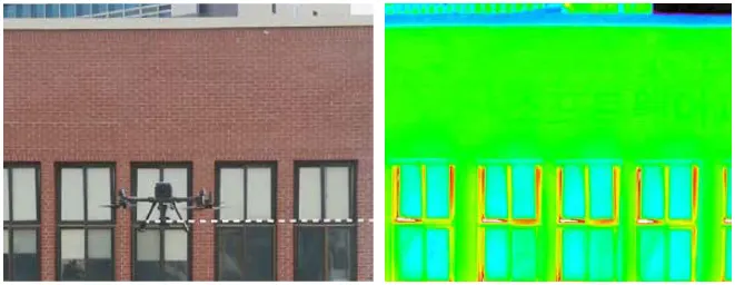
Building Photography
Photograph of a building's thermal image
Development and utilization of energy digital diagnosis technology using drone images
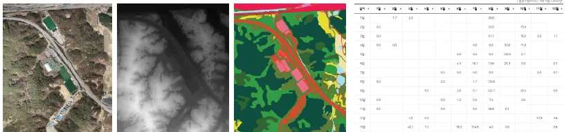
Orthophoto
DSM(DEM)
Land cover
Precipitation data
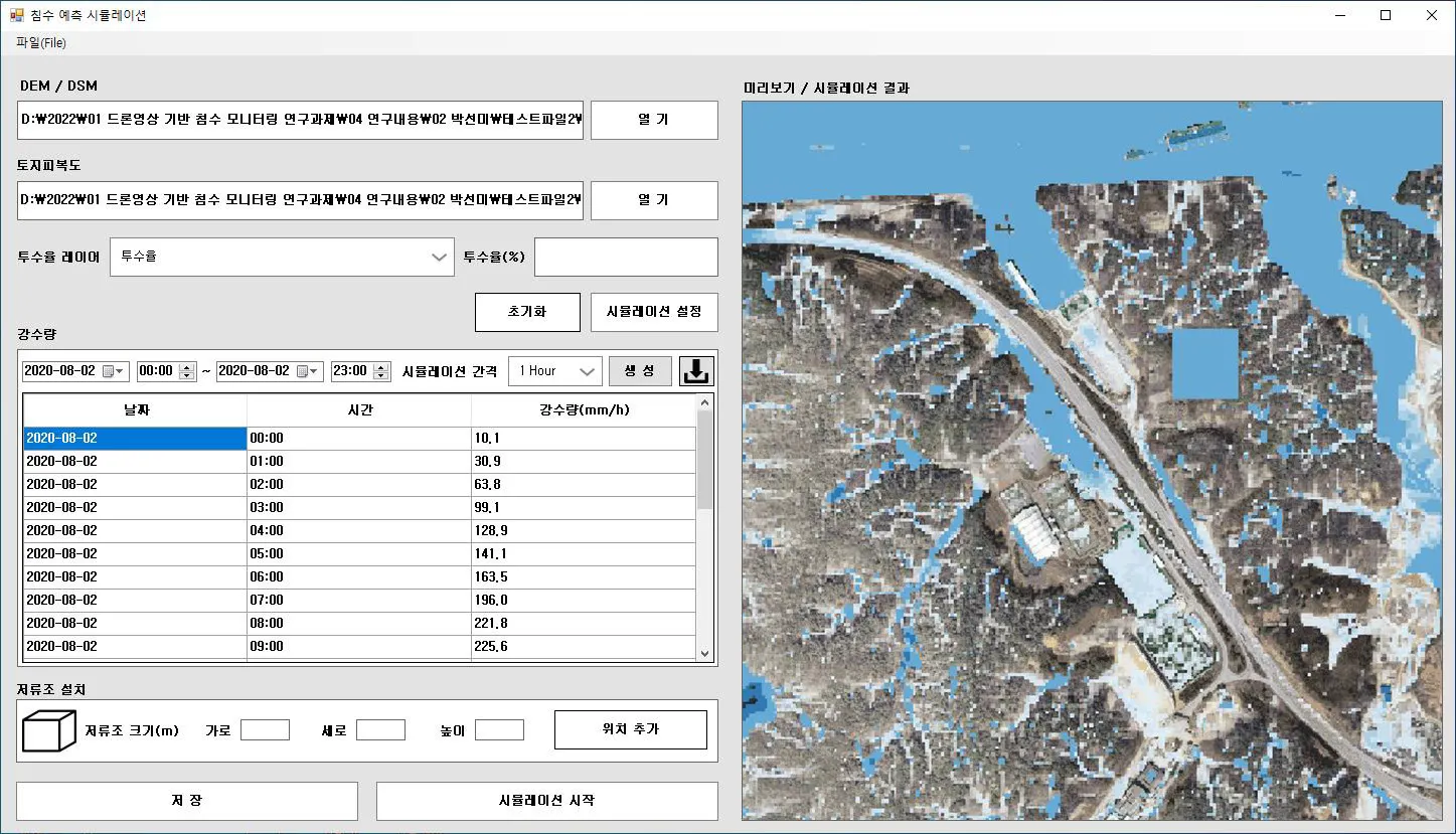
Inundation/Flooding prediction simulation
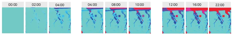
Result of inundation/flooding 2D prediction simulation
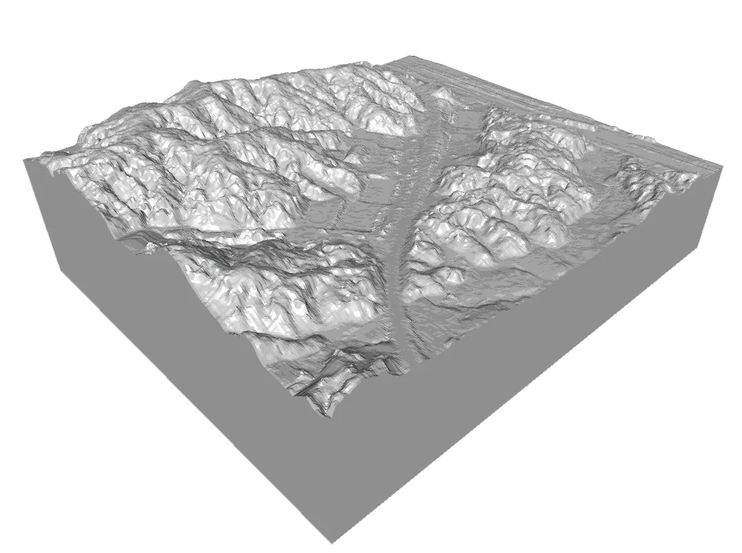
Result of inundation/flooding 3D prediction simulation
The flooding and inundation simulation developed by FMWorks Inc. can predict inundation and inundation according to the digital surface model, precipitation data, permeability rate, land cover rate, and permeability rate information obtained by shooting with a drone. In particular, it always predicts up-to-date situations based on land cover map data learned by artificial intelligence according to location and terrain. In addition, the flooding and inundation simulation has a virtual storage tank installation function, which can minimize the cost of installing non-conforming areas and increase the success rate by finding the optimal location before installing the storage tank. For visualization, simulation results can be checked with the latest orthoimages and 3D modeling, and we will do our best to respond to natural disasters caused by flooding and inundation.