
Advantage
01 Results with high accuracy and detail
02 Fully automated and intuitive workflow
03 GPU acceleration for faster processing
04 Network Processing for Giant Projects
Capabilities
01 Aerial triangulation
02 Alignment of redness images
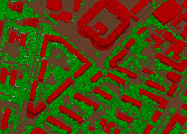
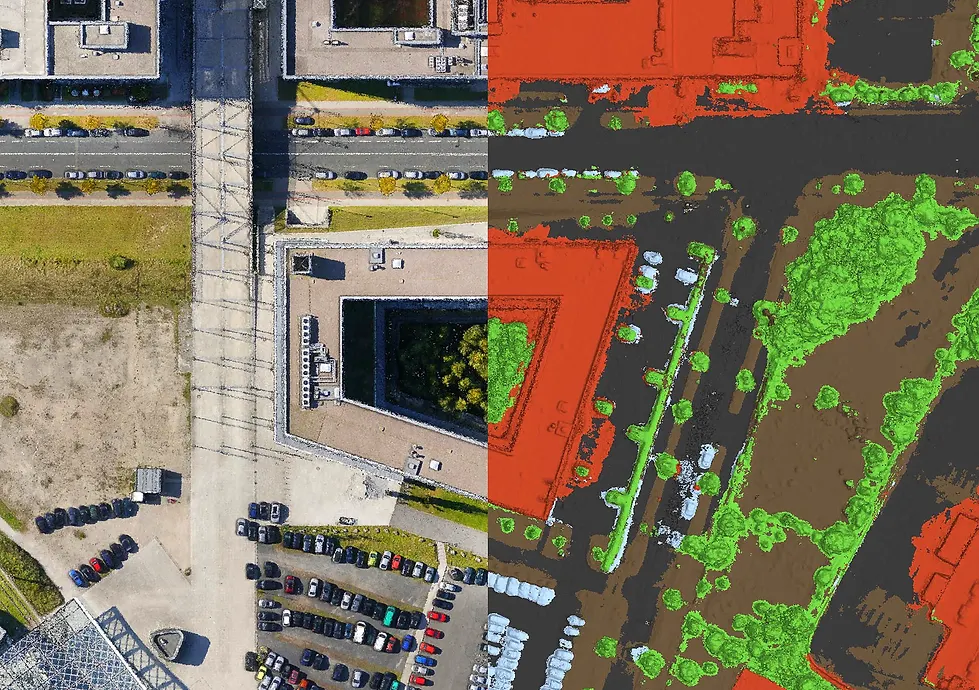
03 Create and classify Dense Point Cloud
04 Create Orthomosaic and DSM/DTM
05 Orthomosaic suture line editing
06 Geo-reparing using aerial photography log and GCP
07 Automatic tracking of specific targets
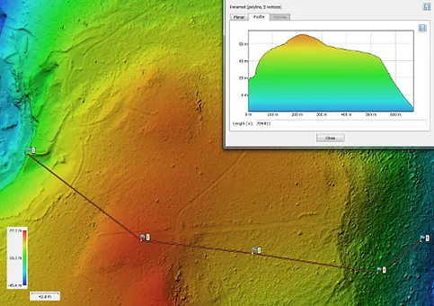
08 Coordinates/Distance/Area/Volume Survey
09 Multispectral image processing and plant index calculation
10 Polygon Model Reconstruction and Texturing
11 Creating and visualizing hierarchical tile models
12 Spherical Panorama Stitching
Compatibiliy
01 Best compatibility with U.A.V. images
02 Results that can be produced in various formats
03 EPSG coordinate support system
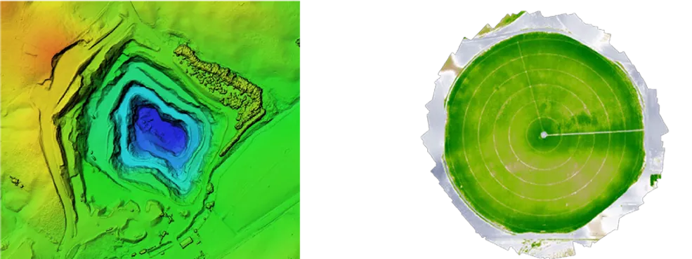
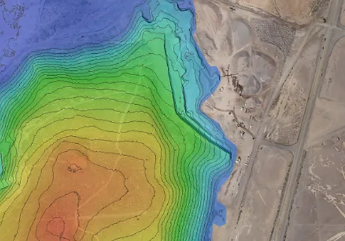
The high accuracy of the polygon model and DSM created by Metashape makes it excellent for area and volume measurements. In addition, the multi-spectral image processing capability allows NDVI to be accurately calculated, making it a useful tool for agricultural projects.
High-resolution DEMs, realistic and sophisticated 3D models created by Metashape, and Dense Point Cloud have multiple potentials.
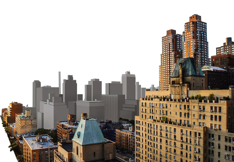
Metashape's network processing capabilities help you reduce large amounts of data processing time efficiently. Everything goes very smoothly with big data through an optimized hierarchical model for urban-scale modeling.
Metashape is a perfect tool for aerial photography. The functions needed for the rapidly growing UAV industry are continuously being developed and supported.It is proven to be an expert post-processing tool that can pre-work the Dense Point Cloud for more detailed DSM/DTM and high-resolution orthoimaging, as well as building a precision polygon model for large-scale subjects.
The highly accurate DEM created through Metashape provides the basis for precise space and volume measurements. It enables volume change tracking, soil erosion, and glacial research, even in multiple flights conducted at different times. Support for multi-spectrum camera images and thermal imaging has infinite integration potential with workflows that include data processing from a variety of sources, such as plant and soil analysis, fire and night studies.