
Co-Development with Korea Forestry Promotion Institute
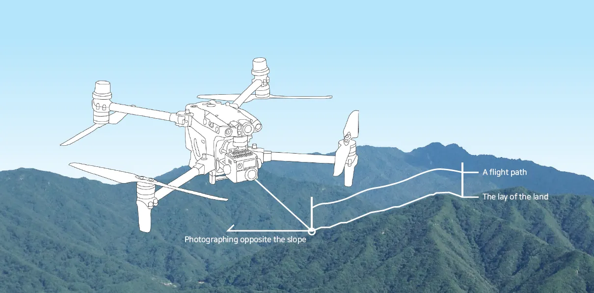
FMS's unique 3D POI photographing provides the most powerful function for photographing slopes in mountainous terrain. In tree management, you can easily obtain near-view and far-view image information using a drone before collecting samples from a large number of trees suspected of being infected with pests and diseases. In particular, in the case of far-views, the slope of the mountainous terrain is reflected to obtain an image that ensures visibility of the object in the opposite direction of the slope.
What is FMS Flight?
A 3D flight path is created by assigning altitude values to each point that makes up the generated 2D flight path, based on information on the distance from the terrain that is predetermined to suit the flight purpose. This is a cutting-edge drone operation technology that creates and flies an optimal 3D flight path by linking it with battery consumption prediction in POI photographing, linear (road) photographing, and area photographing.
.png&blockId=5f54f6d5-e5d6-4d90-83d1-2933a3f7f9de)
3D POI photographing that takes into account the terrain has an excellent effect on saving time and manpower for field investigations and can prevent safety accidents.
Why FMS?
•
This is a drone automatic altitude flight program that reflects the terrain and provides automatic altitude flight and flight path creation services according to the user's purpose using terrain information.
•
The user-friendly interface provides a one-touch method for each function according to the flight purpose, such as 3D route flight, 3D road photographing, and POI flight.
•
Regardless of the skill of the drone operator, high-quality image information can be produced and safe flight is possible.
•
The 3D flight path can be edited on site and confirmed in advance. In addition, it is excellent in terms of spatial information maintenance for applications such as annual business through creation, editing, and storage functions.

Forest fire surveillance using drones
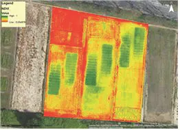
IR Camera: Measuring plant vitality such as NDVI
One-touch Operation for automatic high-altitude flight
FMS's unique 3D POI photographing provides the most powerful function for shooting slopes in mountainous terrain. In tree management, you can easily obtain near-view and far-view image information using a drone before collecting samples from a large number of trees suspected of being infected with pests and diseases. In particular, in the case of the distant view, the slope of the mountainous terrain is reflected and an image is obtained that ensures visibility of the object in the opposite direction of the slope.
Point
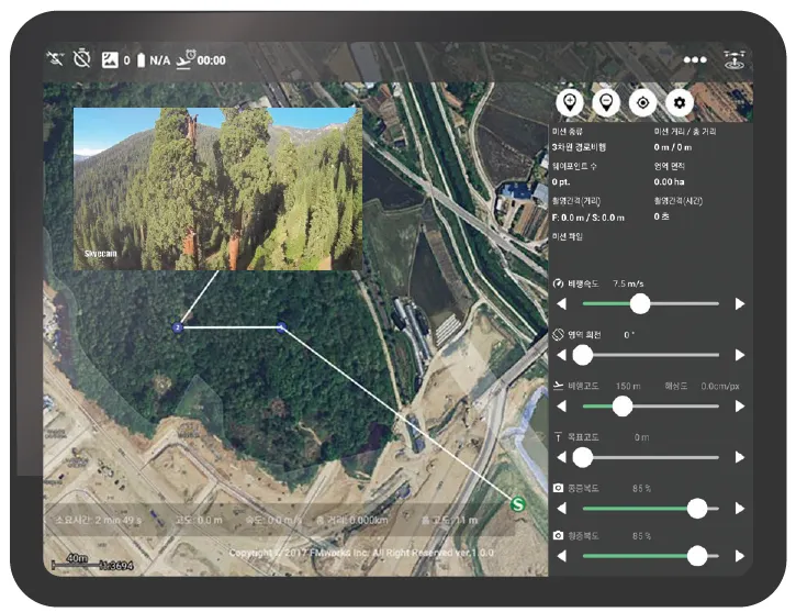
FMS' POI photographing can obtain necessary image information by approaching the object in situations where access is difficult, such as pine nematode disease and various facilities. In addition, FMS provides innovative flight in photographing a number of objects. Shortest distance operations between multiple target points allow you to capture all in one flight.
Line
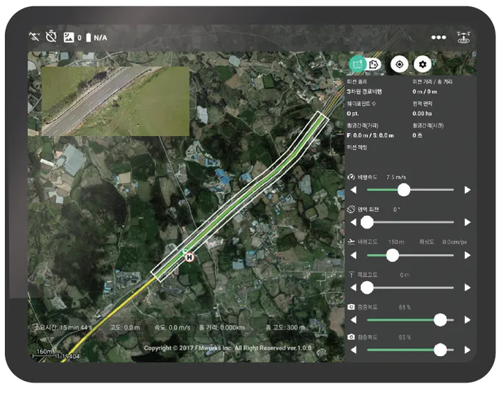
FMS's road photographing makes it easier to shoot by setting the distance between steamers and the number of steamers based on the road center line. Three-dimensional automatic altitude flight is also standard for road photography. We have confirmed successful results by applying it to road photography over 300km.
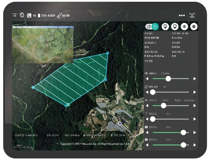
Polygon
FMS's area photographing is a 3D automatic altitude flight that overcomes the difference in altitude of the terrain, and it can produce high-quality image information by maintaining the same altitude as the target. Users can edit the scope of the target site directly on site and upload the target site in the form of a .shp file in advance. You can also use cadastral maps (.shp) as a base map.