
National Geospatial Information Development and Management
FMworks Inc. has cutting-edge unmanned aerial vehicles (M210RTK), filming equipment, and technology, and provides innovative results through technology convergence. It can produce high-quality analytical images throughout land and space information and manage various spatial information.
Based on business experience across the country (near the 38th parallel, Jeju Island, Ulleungdo Island, etc.), FMworks Inc. promises to establish an optimal shooting plan in consideration of its drone operation technology.

Road Occupancy / Slope / Bridge Survey
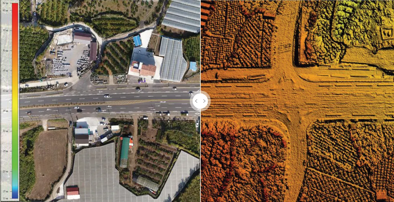
Aeronautical surveillance footage for national land management
DSM production based on aerial photography for national land management
%25EC%2597%2590%25ED%2594%2584%25EC%2597%25A0%25EC%259B%258D%25EC%258A%25A4_%25ED%2586%25B5%25ED%2595%25A9(v4.jpg&blockId=e1960393-4101-4ad7-87ed-9f42327e38c1)
Digital Twin of River SOC
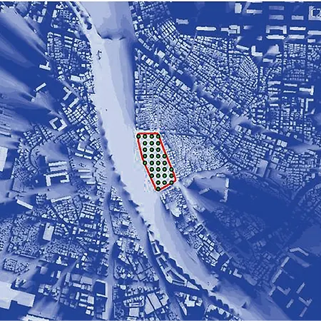
Urban Management and Landscape Analysis
FMworks Inc. has released 3D SA as a landscape analysis tool and has 3D landscape analysis simulation technology. In addition, with future smart cities in mind, we produce high-quality DSMs (Digital Surface Models) through aerial photography considering target altitude to utilize unmanned technologies in terms of urban management (safety, control, distribution, etc.).
Through this, visual frequency analysis (patent 101103340 and 2010) can be performed to construct radio shadow areas and magnetic disturbance information in advance. It is possible to know the area of avoidance such as telephone poles and steel towers in advance. Along with FMworks Inc., these unmanned technologies can also be approached as living technologies.

Origin Visibility analysis
FMworks Inc. Visibility analysis

Scene photograph
Analysis of Mesh Grid

Simulation after development

Simulation of reduction measures
River Surveying, River-bed Change Survey and Analysis
Use drones with FMworks Inc. in water quality monitoring, emergency shooting in flood-stricken areas, and safety management of facilities (dam, embankment, etc.).
Due to the revision and implementation of the River Act, we have accumulated riverbed fluctuation investigation technology using drones, and we have experience in carrying out river survey projects by attaching riders to drones. We also have land surveying, water depth surveying, survey results and river bed fluctuation analysis techniques that meet the regulations for public survey work.
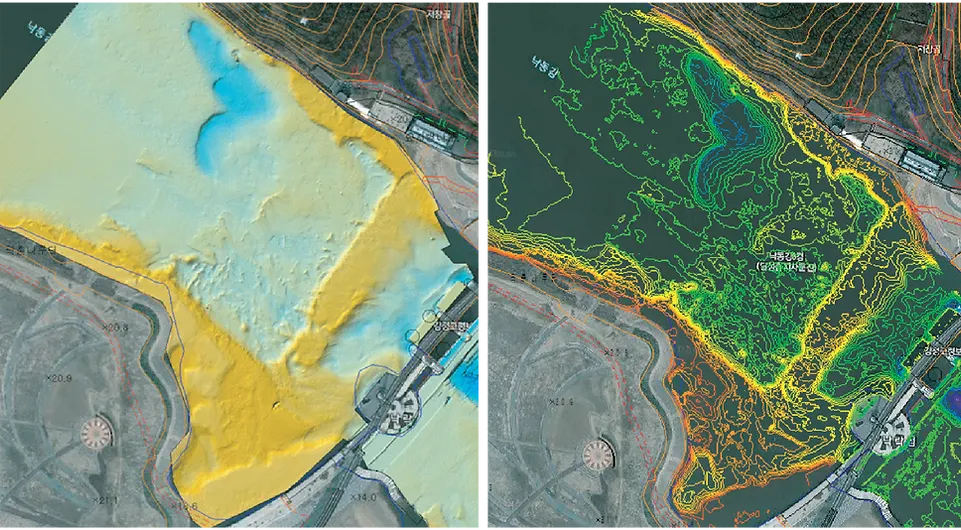
Upstream three-dimensional river channel topograph
3D River Topography Contour
FMworks Inc. supports intellectual and spatial information businesses. In order to complete the Korean version of the New Deal in the field of land information, we will provide innovative land information services by applying aviation survey technology to SOC digitization projects. It contributes to the efficiency of spatial information management and operation by acquiring aerial photographs of target sites (national maintenance, development restricted areas, etc.) using state-of-the-art equipment and producing orthographic images, thematic drawings, and analysis data. In addition, we promise excellent business management and best results based on our unique business performance experience. FMworks Inc. will continue to take the lead in realizing innovative growth of land information and smart land space information services.