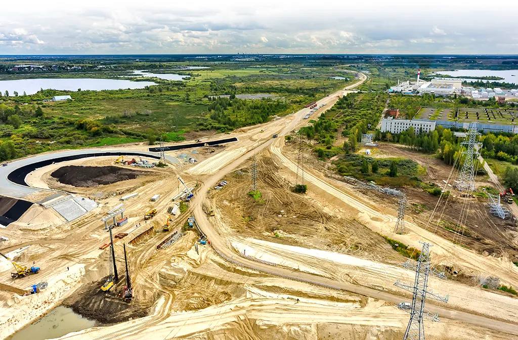
How Are Drones Used in Construction?
Aerial survey in construction sites
•
In the preliminary investigation, drones are used to respond to complaints at construction sites, and digital logging and earthworks are calculated through aerial surveying.
•
It can measure a large area of about 20 minutes based on rotor blades, reducing the cost of making topographic maps by more than 20%.

Ensuring construction site safety
•
Managers can check that construction equipment is in place indoors, cope with accidental situations and operate equipment efficiently.
•
Drones can be deployed in dangerous areas to ensure workers' safety.
.png&blockId=a8c8dce2-427f-4f63-8c1a-e0c206af5644)
Quality control for Construction Site
•
High-resolution video information can be obtained while flying around the construction site. To that end, confirm and analyze construction quality and details.
•
It is used in a method of superimposing and comparing design drawings for each type of construction.
.png&blockId=997d48de-c6f2-4f3c-bf8e-ddb227dc69ec)
Remote Monitoring and Progress Reports
•
It monitors/detects intruders who do not have permission to enter the construction site and secures security at the construction site.
•
It is possible to secure and control workers' safety using wearable equipment, and various attempts are made in connection with artificial intelligence technology.
.png&blockId=b84a645d-1a66-4afc-96ae-a5dd8eb73024)
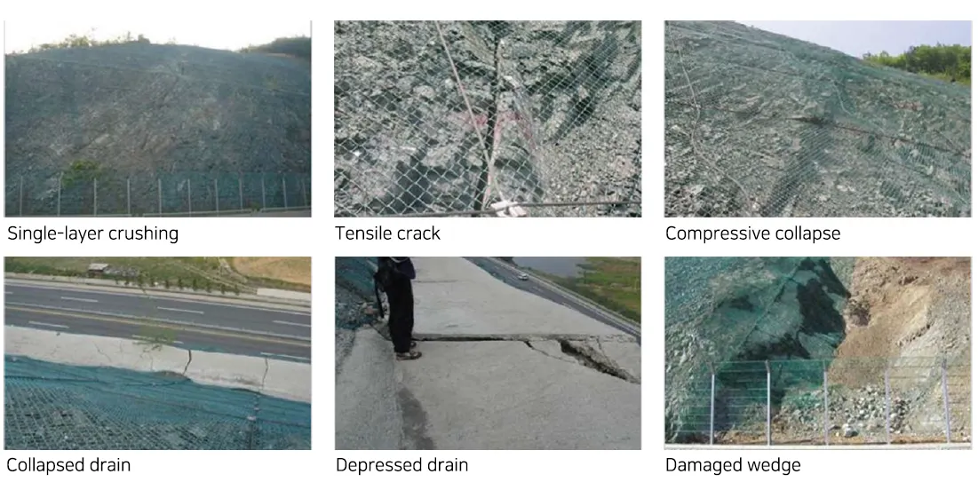
Slope Management on the highway
The Necessity of Slope Management
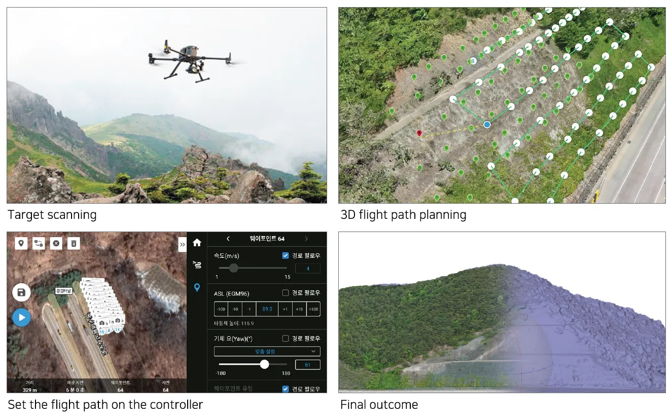
Automatic slope photography
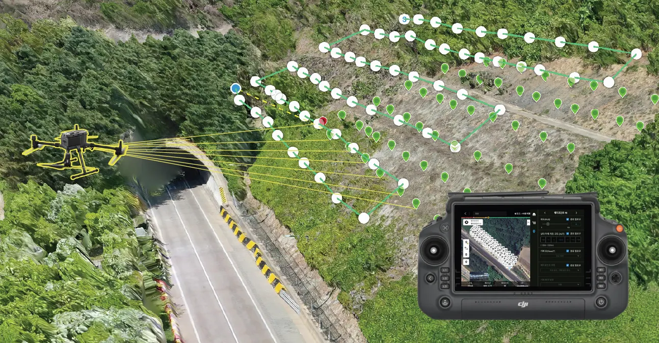
Slope photography processes
Analysis of excavated Rock and Soil Volumes
Why we need calculating the amount of earth and stone mined
The calculation of quarry soil and stone extraction depends on simple experience and short-term planning by experts. We must secure profits quickly and safely. Calculation methods that can cope with the long-term mining industry are needed.
Accurate data are needed to resolve disputes between the work site, guidance and supervision, and public officials in charge. At FMworks Inc., experts with high-performance surveying equipment and drone certificates and numerous experiences can handle it well.
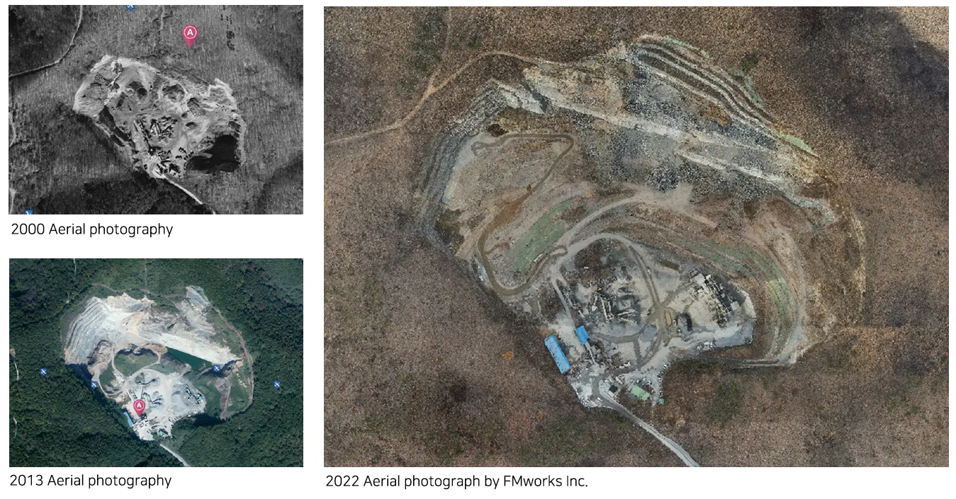
Digitization of Historical Excavated Rock and Soil Volumes
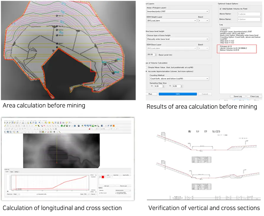
Convert existing floor plans to digital elevation models (DEMs) and calculate volume through GIS and civil engineering programs. US>Verify by converting to vertical and horizontal sections to improve program accuracy.(Error rate less than 1 cm)
Digitization of Current Excavated Rock and Soil Volumes
The L1 that we use is a high-precision, high-quality camera. Real-time previews are available and errors can be found in the early stages. Data measured with a drone (LiDAR) is drawn with 3D modeling, orthographic images, and DEM. Using 3D models, you can understand future mining and predict future mining volume
.png&blockId=5ced2007-7a47-4ff6-ad05-23c7269e4702)
Calculation of mining volumes
Convert the first existing data and the drone (LiDAR) data to DEM respectively. An area and volume amount are calculated by horizontal projection area by utilizing GIS and civil engineering specialized programs.
Calculate the calculated amount by calculating the amount of topsoil, covering, etc. In addition, drawings such as plan view and elevation view can be prepared and compared with existing data. Continuous maintenance is also beneficial because final analysis results are stored for many years.