
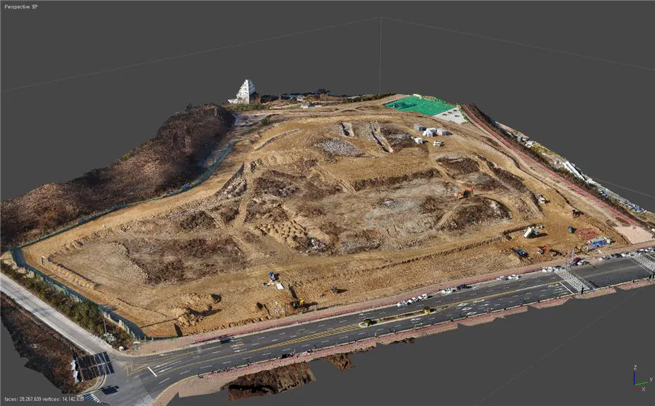
Utilization of drones in construction and civil engineering sites
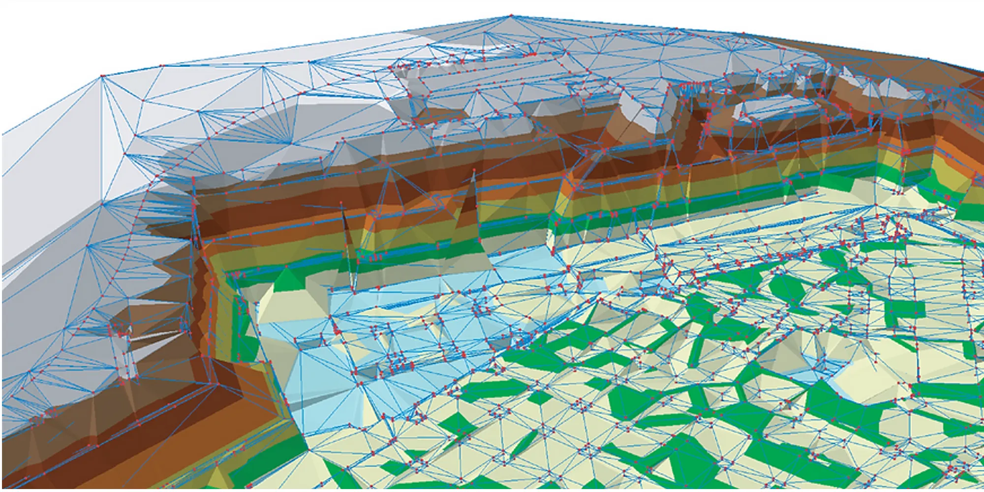
DB construction and safety management of construction sites are carried out using unmanned aircraft, and reliable surveying is carried out even at large-scale civil engineering sites. Based on high-quality images with a maximum resolution of 2cm, the target site can be implemented in three dimensions and compared with planned drawings to quickly calculate the amount of earthworks. This kind of work is carried out empty, so it can be done regardless of the schedule of the civil engineering site.
Tin model for planning drawing and operating
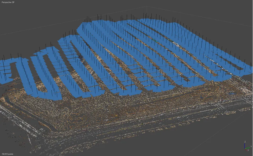
Aerial photography
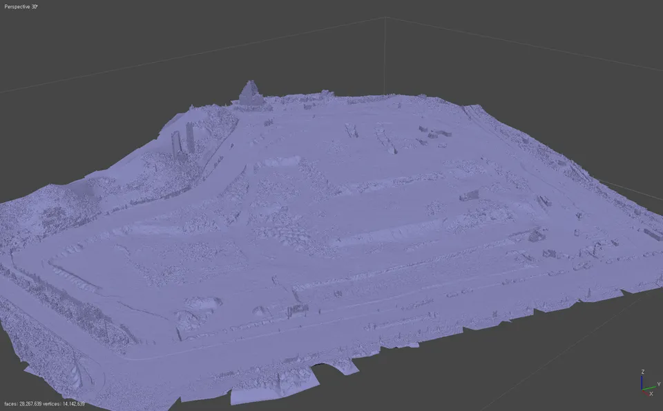
Video matching
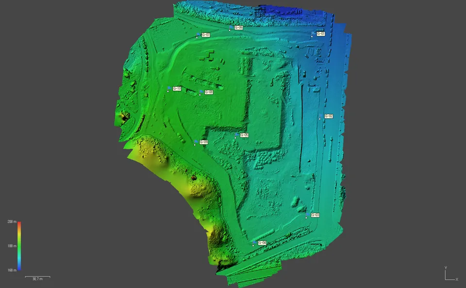
DSM spatial analysis
Field digital twin
Calculate the amount of earthworks using aeronautical survey models and plan drawing models
Automatic Proximity Flight Plan
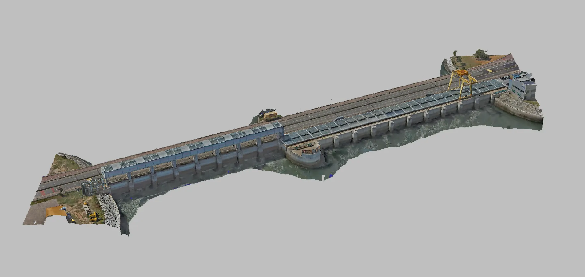
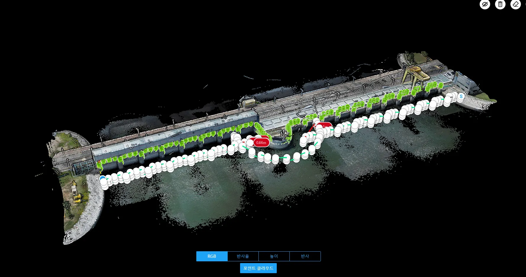
Sihwa Seawall 3D Digital Twin
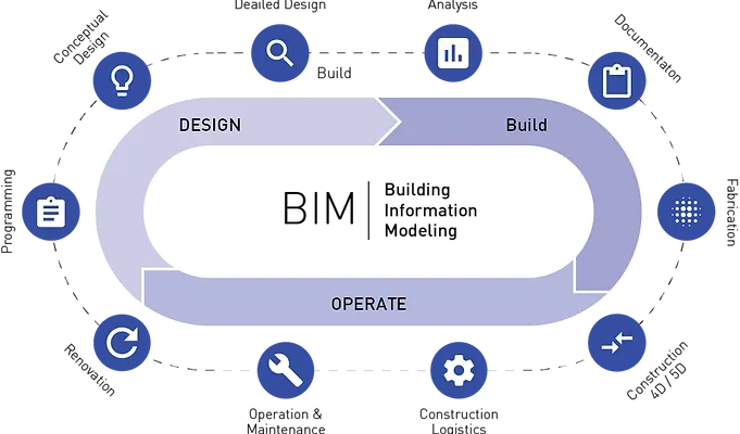
Technological Fusion between BIM and GIS
The members who carry out the BIM project will be accompanied by a master's or doctorate in engineering majoring in BIM and an architectural design, construction, and maintenance expert. They specialize in future-oriented spatial information production.
In particular, new angles of 3D indoor and outdoor space information can be built and utilized through the convergence of state-of-the-art technologies such as drones, GIS, energy performance analysis, and augmented reality.
You can also develop the BIM software features you need in the form of plug-ins, add-ons, and more.
Laser scanning based 3D modeling case study
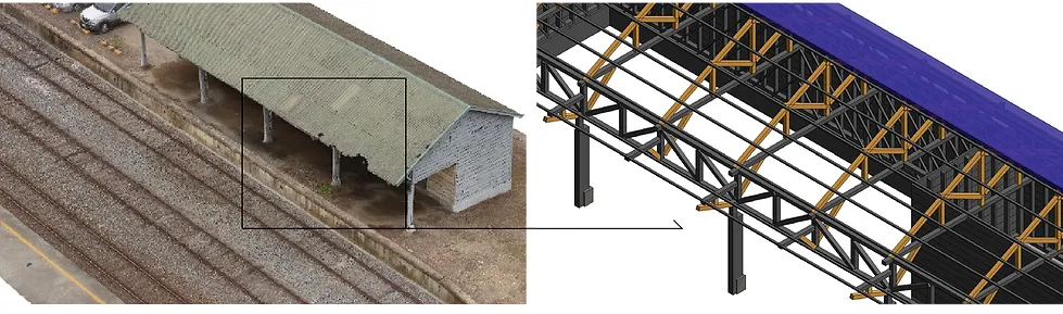
A Case Study on the Reverse Design of Building and Facilities
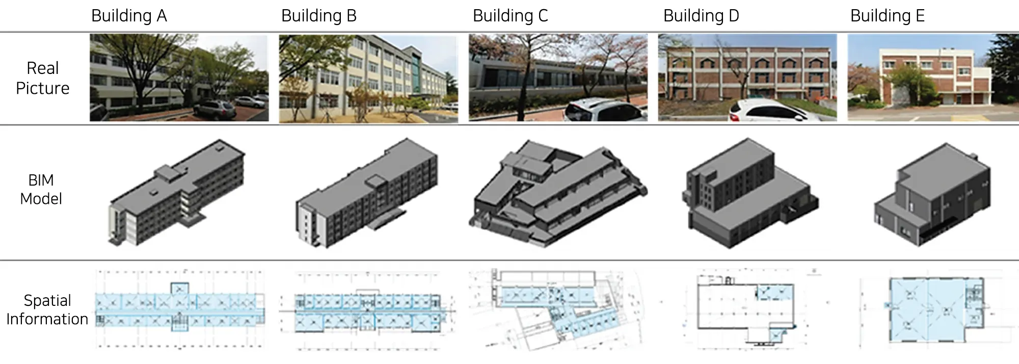
BIM-based spatial information construction case study
BIM Conversion Design of Eonyang-eup Office Building

BIM Design Service Defense Facility Headquarters MEP Modeling

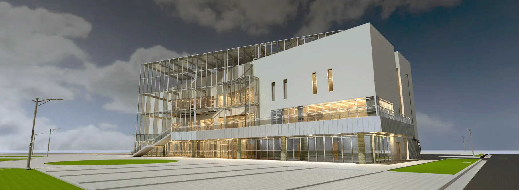
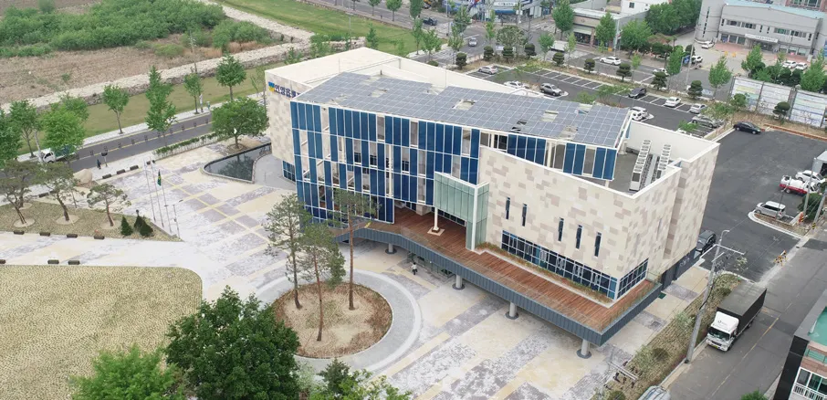
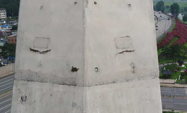
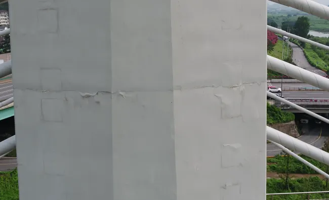
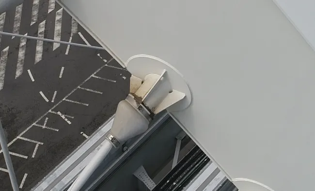
Investigation of facilities using drones

Interior and exterior space design and Spatial information DB construction
FMworks Inc. has representative architects and professionals to support the design and construction of viewing and exhibition spaces while performing architectural design and supervision work. In particular, temporary walls in the exhibition space can be easily constructed using self-developed assembly partitions. In addition, it supports maintenance by constructing indoor and external space information such as 2D plan and 3D stereogram using actual measurement and photogrammetry technology and laser scanner survey. Items for building indoor and external space information can be changed through Level of Detail (LOD) consultation depending on the business purpose. Preprocessing data from raw materials for weight reduction and a 3D model of exact location (location accuracy verification) are typical forms of deliverables. Experience indoor and outdoor spatial information in augmented reality or virtual reality with a variety of smart devices.
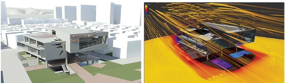
FMworks Inc. strives to apply smart construction technology on-site. The goal is to revitalize smart construction, develop related technologies and industries, improve construction safety and productivity. In particular, new angles of spatial information can be constructed and analyzed through the convergence of advanced technologies such as architectural information modeling, geographic information systems, drones, thermal imaging cameras, virtual reality, augmented reality, big data, 3D scanning. In addition, we specialize in the areas of automation and data production and management that customers need based on specialized personnel in surveying, design, construction, maintenance and major. Solutions that are about to be released include an automation system for facility appearance surveys using drones.