
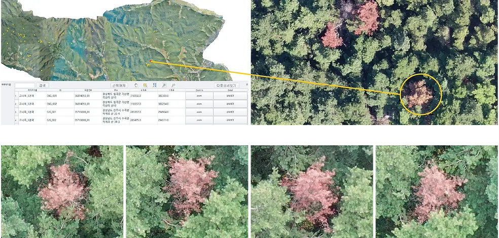
Forecasting of Pine Wilt Disease
The drone is used to obtain the exact position coordinates of the dead tree within 1m. The results of the image analysis are used by each local government and related agency through the orthogonal image management system.
FMworks facilitated field investigations of dead trees through forest POI photography in the pine nematode disease forecasting project in 2019 and verified the reliability of image analysis results. It showed high business performance by developing and distributing QGIS-based image management plug-ins.
Building Orthomosaic for Detection
Orthomosaic Analysis and Management System
Forest POI vertical photography
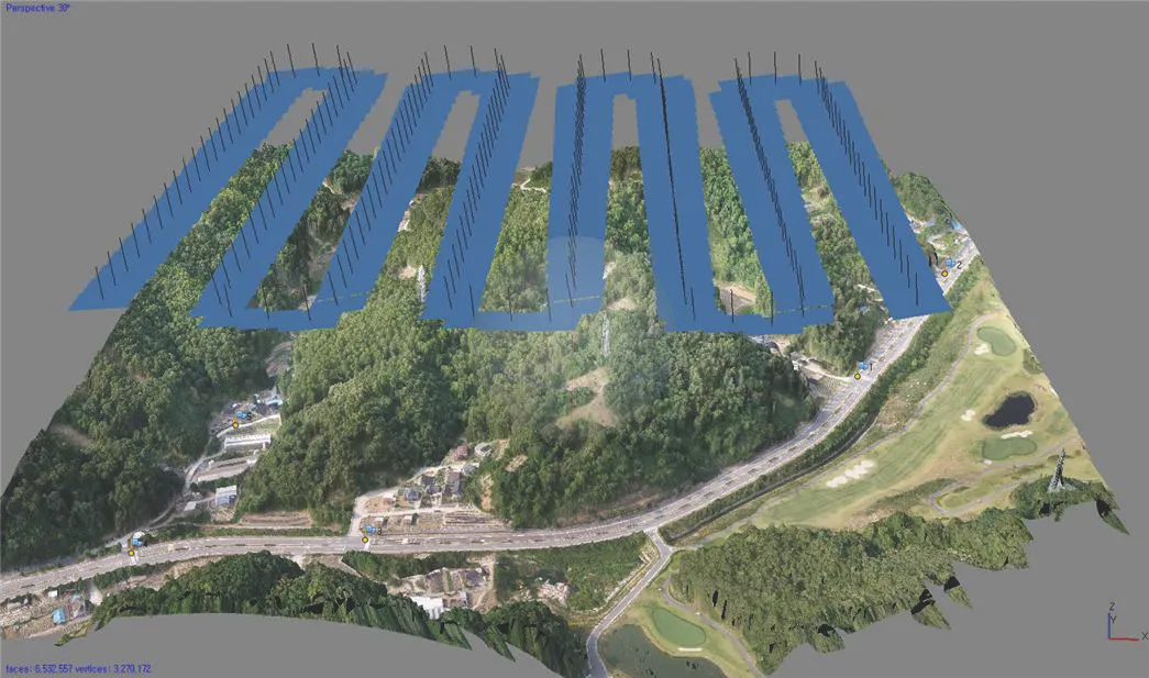
45 Degree four-sided photography
30 Degree left shot
30 Degree right shot
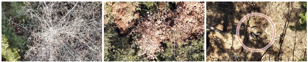
Forest POI Case Study
How are Drone images used?
FMworks Inc. works efficiently with automatic drone flight.
Manual flight, which takes the raw images by directly controlling the drone, is very important
Compared to automatic route flights, longer working hours are required. It is an inefficient method because more batteries are needed, more risk costs, and smaller workspaces.
In conjunction with forest GIS programs such as FGMS and FGIS, the video can be used in many fields, including forest pest prediction, forest development project inspection, and forest disaster area calculation such as landslides and wildfires.
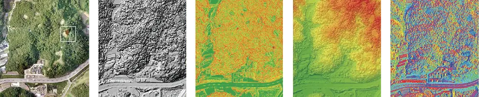
Orthographic image
Shaded corridor
Slope analysis
Altitude analysis
Directional analysis
Thermal imaging cameras such as ZENMUSE XT2 are mounted on drones and used to monitor forest fires. When used in conjunction with FMS, an automatic route flight system, maximum effect can be achieved in the shortest time by using it until night. It can also measure plant vitality using IR cameras.
열화상 카메라: 산불 뒷불 감시용
IR 카메라: NDVI 등 식물활력도 측정
Drone Utilization: Mowing Project
By using drones for comparison before and after the mowing project and overall business management, you can intuitively control and manage a wide range of business targets at a glance. In addition, by analyzing drone images, it is possible to accurately compare whether or not the work is done before and after the project.
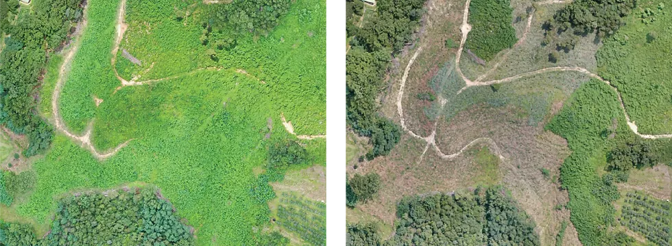
Before mowing
After mowing
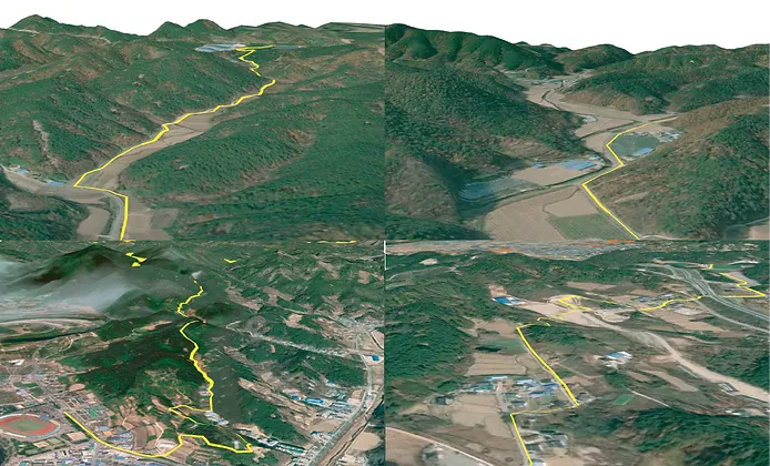
Design of 3D Hiking Trail
When planning hiking trails, remote exploration is possible by creating virtual routes in large-scale target areas without going to the site. These remote exploration simulations support intuitive and rapid decision-making. In addition, it can be printed as a moving video along the hiking trail, and drone videos can be mapped together to produce promotional videos tailored to the latest status.
Examples of Utilizing Hiking Trail 3D Model : DEM, shadow undulation, altitude analysis
Remote Exploration Videos of Hiking Trail
Simulation for forest digital twin landslide
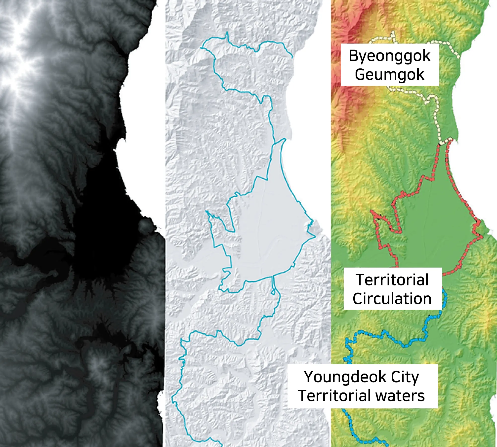
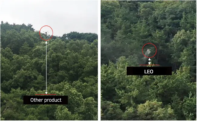
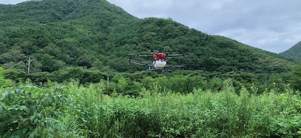
Forest Aerial Spraying of Pine Wilt Disease : LEO
It supports precise 3D autonomous flight. Save up to 50% in forest management and pest control. It has excellent control effect by minimizing the scattering of chemicals through precise close flight
It can also quickly and accurately control areas where it is difficult to access the target site and secure the pilot's view. It plays a leading role in cutting-edge forest management and plant disease pest control to prevent secondary accidents such as forest fires caused by drone crashes. FM Works completed the pine tree nematode disease control project in Dong-gu, Seo-gu, Buk-gu, Suseong-gu, Dalseo-gu, and Dalseong-gun in 2019, and the Forest Control Solution (LEO) is undergoing product registration by the Public Procurement Service.
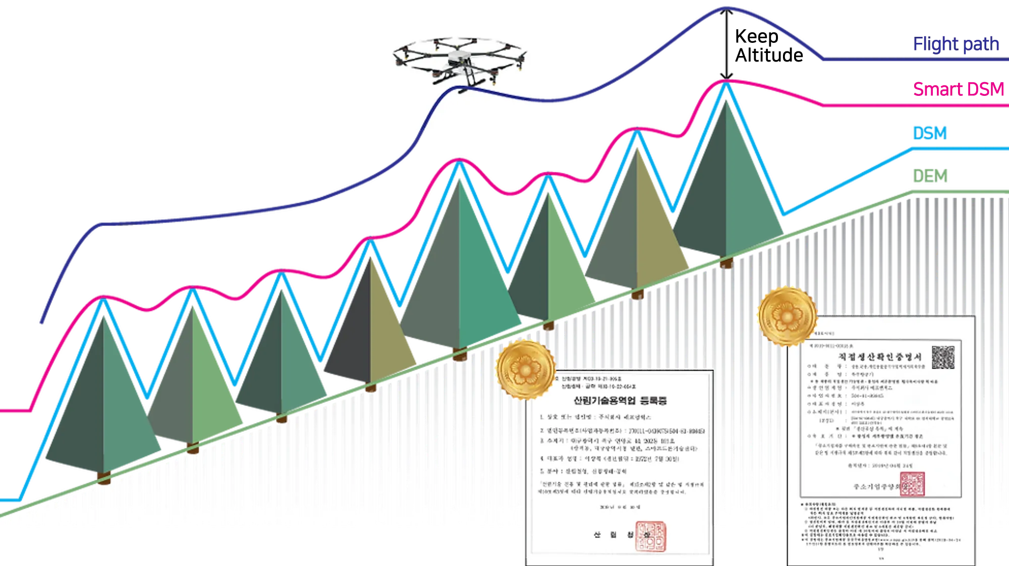
Comparison between Aerial Spraying Using Smart DSM and other techniques

Ministry of Trade, Industry and Energy's project to support creative industrial base institutions, "Project to build a technology foundation using smart drones for safety convenience services”
Registration of forest technology service business / Production verification certificate of multipurpose special aircraft
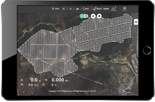
Autonomous Flight Paths and plans for LEO Forest Control Solution
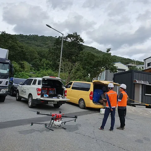
Drone(LEO) based Aerial Spraying for Pine Wilt Disease in 2019